Sunday, July 7, 2013

Skagway


After reluctantly leaving Takhini Hot Springs (and considering staying another night, but deciding not to)¸it was off to Skagway. That meant crossing the border into the US again, often a trying event, but this one wasn't too bad. But first things first.
It was a beautiful sunny day, some wispy clouds, but not many, and I had to drive through Whitehorse. My car was still feeling the effects of the Top of the World dust and Dawson City mud, and I remembered a really good car wash in Whitehorse. The man who washed my car the last time was there again, and again he washed my car.  I was amazed how the sunshine and a clean car raised my dragging spirits.  I was eager to see what lay ahead.

The  first pulloff was for the Robinson roadhouse on the rail line from Skagway to Whitehorse.  Built at the turn of the 20th century, it was a ruin now, but a very picturesque ruin. And the sun was bright, and the flowers were blooming, so I spent a good 45 minutes walking around here and exploring the grounds, even if I couldn't enter the buildings. At least I could peek inside! If I were a painter, a painting of the log remains with fireweed beside the door would be my next subject.  Alas, I'm a quilter, and not an art quilter, but I may try to do something with this picture one day.


There were a lot of really pretty pull offs along the way, but this one, at Carcross and the head of Bennett Lake were  fun to see. This is where the stampeders (the gold seekers of 1898-99) ended up after climbing the Chilcoot trail with their 1000 pounds of goods (enough for a man for a year) and then building their boat to get them from the end of the trail to the top of the lake. I can't imagine what that must have been like.

But Skagway was the destination, and I made it there about 1 PM, just in time for lunch of halibut and coleslaw. The halibut was great, the coleslaw, not….Whoever heard of dousing coleslaw with poultry seasoning?  Second order of business, after lunch, was a haircut. After 6 weeks on the road, I was desperate, and the visitor information center had just what I needed – the name and phone number of a local hairdresser. The person at the center even called her, and she had time right then to take me.  Getting a haircut from a new hairdresser is always an iffy proposition, but I was really lucky, and got a really nice cut!

It seemed like a good way to get to hear a little about the town was with a walking tour with the National Park Service.  It was actually quite interesting to learn about the early history of Skagway and the Gold Rush from a ranger, especially one with a sense of humor like this one had. We heard about the con artist Soapy Smith and the shootout with  ?? Reid (both were killed), about one of the first saloons (now restored, with mannequins) and the earliest settlers (Captain Moore and his son Ben).


Sunday morning was the train ride to the summit of White Pass, the route that some of the stampeders took after it was built. It's a lovely ride, with beautiful scenery, but some wicked drop offs and narrow canyons that really get the heart beating.  What I found most interesting in the pictures is that when I took them through the glass, I got the reflection of some of my fellow passengers in the photo.  That was quite unexpected.


The summit of White Pass

In the afternoon, my destination was Dyea (prounounced DieYee), the original indigenous settlement in the area. This is the trailhead for the Chilcoot Trail to Bennett Lake. At one time about 8,000 people lived here, and there was a wharf a mile long to get to deep water. All that is gone now, and the town site is reclaimed forest. I had imagined short trees, kind of few and far between, but I was very wrong. The trees were tall and thick, and there was a trail winding through them (on which I got lost and had a heck of a time finding my way back to the car). But it was fun to see and imagine – something that I've been doing a lot! The road to get there was also a challenge. The guide books didn't describe the road at all, so I assumed a paved two lane road going through the forest and coming out near the water. Oh no; it was a gravel one lane road hugging the side of a cliff, part of which had been blasted out to make room for the road. It was winding, with lots of blind curves, and made driving – well, shall we say – interesting. Not a road I'd like to do every day of the week!

View to ocean from the road


That winding road...
Tomorrow it's back to Canada to Whitehorse (customs again…) to stock up for the next few days. I'm headed down the Cassair Highway to the little towns of Steward and Hyder, one in the US and one in Canada, on the coast of BC.  I've heard that bears congregate there for the salmon run, so I'm hoping to see some bears, and maybe eat some more salmon. Internet could be sketchy, so I'll post another blog when I can.  Till then, dream your own dreams!!

Saturday, July 6, 2013

Dawson City to Takhini Hot Springs


Wow, it's been a lot of miles since I last posted!  I spent a couple of days in Dawson City, the premier city of the Alaska gold rush (before Nome had a strike), then a night near Whitehorse at a hot springs (a very nice afternoon!) and now I'm in Skagway.

Let's see, Dawson City – the best word for that is colorful.  It's that not only in character (which it is in spades) but also visually. I have never seen so many pink and purple and turquoise and coral and yellow and blue and green houses, all with a second color (not usually white) for the trim.  It seems it's a law in Dawson City that they have to be that way, and it sure makes for a happy, cheerful city. Only the main street is paved, all the rest are dirt, and it rained while I was there, and the streets turned to mud.  Yuck – what a mess it made of my car. It was so bad I washed it myself when I got back to the campground, and I've NEVER washed my car myself (that's what car washes are for, right?!)


Colorful in a different way...
The people are also very colorful, in that they are personable, fun to talk to, and often live lifestyles that would seem "odd" to us.  One of the tour guides talked about how she spent her first two years in Dawson living in a tent on a hillside on the west bank of the Yukon. There are no services there – no water, electricity, gas, phone, sewer…..and she still lives there, although now in a cabin (with a 3 year old).  She has an outhouse, carries water in 5 gallon jerry cans, and there is now cell phone service on that side of the river. I can hardly imagine what that would be like (of course, that's the life I've led for the last 6 weeks, sort of….)

To get to Dawson City from the campground where I stayed I had to take a ferry.  There is no bridge across the river, but the ferry is free – provided by the city.  You can get about 8 cars at a time on the ferry, and if one of them is a big RV, that count goes down drastically. I was told that over the July 1 holiday (Canadian Independence Day) the wait was 2 ½ hours to get across the river!

I did a walking tour of the city where the guide told stories of unusual characters, like the madam who had a going concern up until the 1960's (and she showed us the "cribs" where the ladies of the evening worked), and about a drink called the Sourtoe Cocktail, that is a shot of liquor with a toe in it.  There is a legend that goes along with it, but there is also a club of the people who have actually had one of these. In order to be a member, when you drink the shot, the toe has to touch your lips. No, I didn't join that one…. Like I said, Dawson City is very colorful!

Dawson Main Street

One of many little gardens
Robert Service, the poet, did some of his writing here, and I got to see his cabin. It's very small, and very spare, but it was kind of fun to see where he worked. There is a Jack London cabin here too, but although I saw the outside, I didn't go in.

Another author whose books I have read is Sue Henry. She also writes about Alaska, but her main character is a woman who raises and races sled dogs. One of her books is about a sled dog race, similar to the Iditarod, called the Yukon Quest. The road south from Dawson follows the route of this race, and I wanted to see it also, so I spent a day driving it. It was fun to see the places mentioned in the book, and to watch the rivers and lakes. Boy, there are a lot of them.  This one was particularly pretty, and the young man who took my picture was fun to talk to. 


5 Finger Rapids on the Yukon River
My goal that night was somewhere close to Whitehorse, so that today would be an easy trip into Skagway. As I read about the route in the Milepost, I saw a mention of Takhini Hot Springs, and thought that's it – that's where I'm going to spend the night. I got in mid-afternoon, and spent a delightful couple of hours soaking in the springs, getting all the dust and mud of the Top of the World and Dawson City off me. That and cool weather made for a really good sleep last night!

Takhini Hot Springs (the pools are behind the fence)
Today has all been 1898 gold rush history, the Chilcoot trail, and the effects on Skagway.  Tomorrow (Sunday) I'm taking the train from Skagway to the top of White Pass, another of the routes to the gold fields of the Yukon. So I'll combine those two days tomorrow (or Monday)…story to be continued!


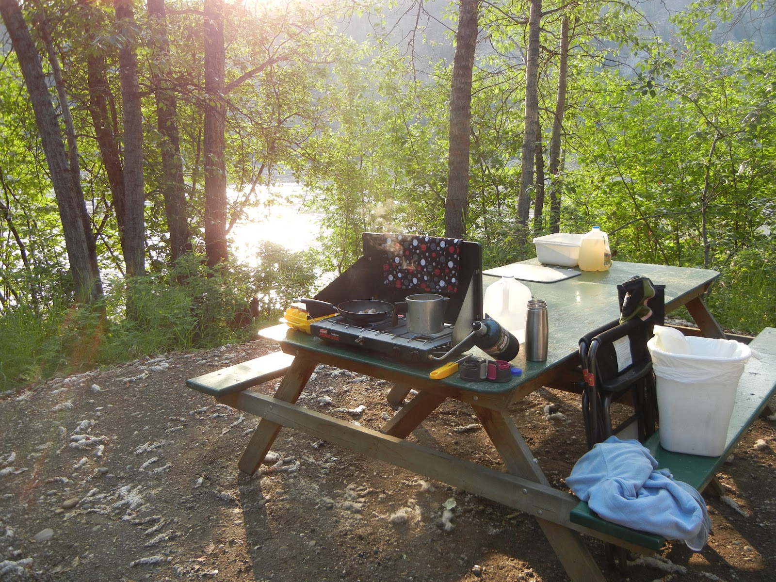
Cooking breakfast the last morning in Dawson City.


Thursday, July 4, 2013

Chicken and Top of the World


No, these aren't states of mind, or song titles; they are the places I've been the past couple of days. Internet access has been sporadic, and in one case, limited to 30 minutes—and it's timed. ( I didn't know libraries could do that, but one did. So no Words with Friends with my kids (at least for a couple of days) – it takes too long to make a move!)

Long ago I had decided that on the way back to the lower 48, I didn't want to drive the same route, at least not all of it. Luckily, there are options, and yesterday and this morning I drove one of those options. An alternate route out of Alaska is called the Klondike Loop, consisting of the Taylor Highway from Tok to Chicken (yes, there really is a place named Chicken in Alaska), and the Top of the World highway from Chicken to someplace in Yukon, then the Dawson Highway into Dawson City. There's more after that, but these are the parts I've driven so far. And I spent the night in Chicken!!


It is a cute little, well, town is not really the word for it – more like hamlet, maybe. There are 3 RV parks, each associated with its own shop and restaurant, and a Post Office. That's it.  I stayed at the Chicken Gold Camp, which has an old gold mining dredge prominently displayed on its grounds, and a gold panning center right near it. On a hill nearby is a statue (very tall) of a chicken, apparently made from discarded school lockers, next to a signpost listing chicken-related cities and where they are. Kind of memorable in the middle of the Alaska Bush!  This is the jump-off point to the Top of the World highway, a famous (or infamous) road with a reputation of being difficult to drive. It's gravel for about 40 or more miles, and people I talked to said there were very narrow places, and steep drop-offs, and I started out more than a little nervous.  I don't like heights, so the idea of this one kind of scared me, but I really wanted to do it.  I needn't have been so nervous – I've driven much worse roads in Colorado (from Durango to Montrose – but that's another story!). Yes it was dirt and gravel, yes there were some slopes, but not really bad drop-offs, and yes, there was construction and a few rough parts. But I'd drive that one again in a heartbeat, whereas I will NOT drive south from Montrose to Durango over that highway (but like I said, another story!).


The top is truly beautiful – you can see forever, and the mountain ranges seem to go on and on. There were a turnouts that I took advantage of, and thoroughly enjoyed the drive. Especially the part where I came around a bend and saw 3 moose in front of me – a mama and two babies.  Luckily, this time I was far enough away from them that mama didn't come after me, but she stood there looking for a long time. The whole way across that part of the road I kept hearing the old Carpenter's song "I'm on the top of the world looking down at creation…." funny how that came back to me!

Now I'm in Dawson City, the first capital of the Yukon, and the center of gold mining at the turn of the last century. I'll save that for the next entry, but leave you with this picture of what I see from my campsite. It's the Yukon River…up close and personal!!

Monday, July 1, 2013

Down Time, and Little Stuff


Do you ever get to the point that you just can't absorb any more beauty, or information, without a little time off?  That's where I've been the last couple of days. Realizing that I'd driven up the Glenn Highway without really seeing it... Of course, I stopped at the photo pulloffs (marked with prominent signs, thank you Alaska Highway Department), but I'm sure there was other stuff I missed. Thankfully, I did miss the moose that came tearing across the road right in front of me, with a car not very far behind!

Matanuska River -- from a crumbling overlook that scared me a lot!

Manatuska Glacier
After leaving Seward, I drove to Palmer, a little north of Anchorage, as a good waypoint for the next leg of the trip to the Top of the World. I just wanted a place to spend the night, but when I started looking around, I found a Presbyterian Church, and the next day was Sunday, and this looked like a very interesting church. Service at 11.  It is a log church, built in the 1930's, logs both inside and outside. No pictures (such was the state of my brain L). The service was very familiar, and it was nice talking to the co-pastors after the service.

My goal on Sunday afternoon was Tolsona, near Glenallen. I stayed at this campground on the way up, and thought it was the most picturesque one of all the ones where I had stayed. I've got a stream gurgling right behind the camper (when I was here before it was roaring) and it's very restful at night, after I get rid of all the mosquitos that find their way into the car.  That's the only problem with this place, lots and lots of mosquitos.

There was a little sightseeing on the way up here – the Independence Gold Mine was touted in the Milepost as a place not to miss. They were right – I'm glad I took the time and energy to see it.  And the creeks alongside the road were beautiful.  I think they are my favorite kinds of photos – I call them the wet ones. 

Independence Gold Mine

A wet picture!
One of the things that I see very often along the road is lakes or ponds full of water lillys. They have all been the yellow ones, but they are really pretty.  Sometimes the lakes, and the water lilies, seem to go on forever.


I decided to stay here two nights, to really rest and recharge, plus I had to do a major laundry (sheets and towels too!) and I hadn't cleaned out the camper in a while. With the laundry in the washer, I unloaded everything from the van, except the bed and chest of drawers, cleaned it out as best as I could, and wiped down all the surfaces that had become terribly dusty. It's amazing how that stuff accumulates, and the nooks and crannies it gets into!

All along, the mosquitos have been pretty bad, and it's been quite warm in many places, making it hard to sleep. At one point I stopped at a Lowes hardware store and bought some fiberglass screening, thinking I could improvise screens for two of the windows and then leave them open at night.  Screening and duct tape!  I'd used them several times and they seemed to work, but it was a pain in the neck to put them up when I arrived at a campground, and remove them the next morning. So my bright idea today was to see if I could get them up and leave them up without danger of them flying off while I was driving. By folding the edges of the screening over the edge of the door and taping it down, I think this will work! When I get home, I'll do something more adaptable – kind of like an elasticized bowl cover that I put over the door, then close the door on it. I'll use screening and fabric for the cover, though. I just hope it's legal…maybe Eric can put in his two cents here!


One kind of exciting thing has been happening – my clothes are becoming way too big for me! I'm having a hard time keeping my pants up (but I did bring a belt…) Without all the junk, and keeping all the food in the back of the van, I'm eating quite a bit less and losing some of my unwanted weight. I hope I can keep it up when I get home!

Food on this trip has been both good and bad.  Because I'm using a cooler, and don't have long-term storage facilities, I've been a bit more limited in my food choices.  Have you ever tried to go the store and buy a package with just one chicken breast?  Nope… it's always 3 or 4 of them, and I can't eat them fast enough to finish them up. When stores have butcher counters, I usually buy meat there, and I can get the small quantities that I need. One steak lasts for two meals, one chicken breast, the same. I've had a lot of salmon – that I can get in the small enough portions, and I could eat that several nights in a row (and I have!).  There's been a lot of stir fry, or noodles or rice mixed up with some kind of meat. One thing I discovered is that I get really tired of salads every day.  But I really like cut-up raw vegetables with a little bit of dip.  I also love grilled vegetables, and I've done a lot of asparagus, or zucchini mushrooms and onions. Corn also grills well (I have a small gas grill that works on the regular camping propane bottles.)

I've ended up tossing quite a bit of chicken (when I had to buy a larger package), and bread too, because I can't eat it fast enough. But I decided that's a small price to pay for fresh food. I tried burgers one night, and they were so awful, I vowed not again on this trip. If I really want a burger, I'll go to a restaurant!